


313NI - NINTH Voting District, Whitfield County, Georgia
About
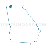
Outline

Summary
| Unique Area Identifier | 563144 |
| Name | 313NI - NINTH Voting District |
| County | Whitfield County |
| State | Georgia |
| Area (square miles) | 17.96 |
| Land Area (square miles) | 17.94 |
| Water Area (square miles) | 0.02 |
| % of Land Area | 99.88 |
| % of Water Area | 0.12 |
| Latitude of the Internal Point | 34.82443160 |
| Longtitude of the Internal Point | -84.88970120 |
Maps


Graphs
Select a template below for downloading or customizing gragh for 313NI - NINTH Voting District, Whitfield County, Georgia


Neighbors
Neighoring Voting District (by Name) Neighboring Voting District on the Map
- 2131039 - SHUCK PEN Voting District, Murray County, GA
- 2131895 - SPRING PLACE Voting District, Murray County, GA
- 213824 - TOWN Voting District, Murray County, GA
- 313ES - EASTSIDE Voting District, Whitfield County, GA
- 313GL - GROVE LEVEL Voting District, Whitfield County, GA
- 313LT - LOWER TENTH Voting District, Whitfield County, GA
Top 10 Neighboring County Subdivision (by Population) Neighboring County Subdivision on the Map
- Dalton CCD, Whitfield County, GA (74,005)
- Chatsworth CCD, Murray County, GA (19,527)
- North Whitfield CCD, Whitfield County, GA (12,508)
- Crandall-Eton CCD, Murray County, GA (10,947)
Top 10 Neighboring Unified School District (by Population) Neighboring Unified School District on the Map
Top 10 Neighboring State Legislative District Lower Chamber (by Population) Neighboring State Legislative District Lower Chamber on the Map
Top 10 Neighboring State Legislative District Upper Chamber (by Population) Neighboring State Legislative District Upper Chamber on the Map
Top 10 Neighboring 111th Congressional District (by Population) Neighboring 111th Congressional District on the Map
Top 10 Neighboring Census Tract (by Population) Neighboring Census Tract on the Map
- Census Tract 102.02, Murray County, GA (9,104)
- Census Tract 4, Whitfield County, GA (8,810)
- Census Tract 11, Whitfield County, GA (5,171)
- Census Tract 105, Murray County, GA (5,087)
- Census Tract 2, Whitfield County, GA (4,253)
- Census Tract 3.01, Whitfield County, GA (4,154)
- Census Tract 1.01, Whitfield County, GA (4,067)